
| PROJECT: | LJUBLJANICA RIVER BANKS |
| SOURCE: | COMPETITION PROJECT - RAISED 2nd PRIZE |
| CLIENT: | THE MUNICIPALITY OF LJUBLJANA |
| SITE: | LJUBLJANA, SLOVENIA |
| PROGRAM: | PUBLIC, CULTURAL, RECREATIONAL, EDUCATIONAL |
| AUTHORS: | BREDA BIZJAK, LORENKA STROPNIK, DOMEN Å EGA |
| COWORKERS: | MARKO COLONI |
| DATE: | 2004 |
The river Lubljanica is valued as one of the greatest spatial potentials in the city of Ljubljana. With selected projects, our aim is to change the perception of the city and the river. We suggest the river Ljubljanica to become a navigable experience route that would challenge residents and visitors of the city, to stimulate the desire for discovery and to accelerate the city rythm. What is to be done to make the river Ljubljanica the most attractive and interesting ambience of the city and the “Špica” the most popular urban park? Is the natural and attractive power of water enough to experience the river over and over again?
What kind of settlement would be appropriate and which one would be attractive, after all, not only for the residents of Ljubljana but also for all the visitors? We are asking ourselves if it would be possible to put a topography that combines landscape qualities and built structures between the skyscrapers near the river in the Moste area, to locate a linear park sweeping gently to the river with terraced tree-planted avenues along the most monotonous street in the city, to watch trains from a raised sequence park above the railway?
Our suggestions for the river ambiences are found in the environment characteristics as a key element that creates a new layer of river identities and preserves specific characteristics eminent for this area:
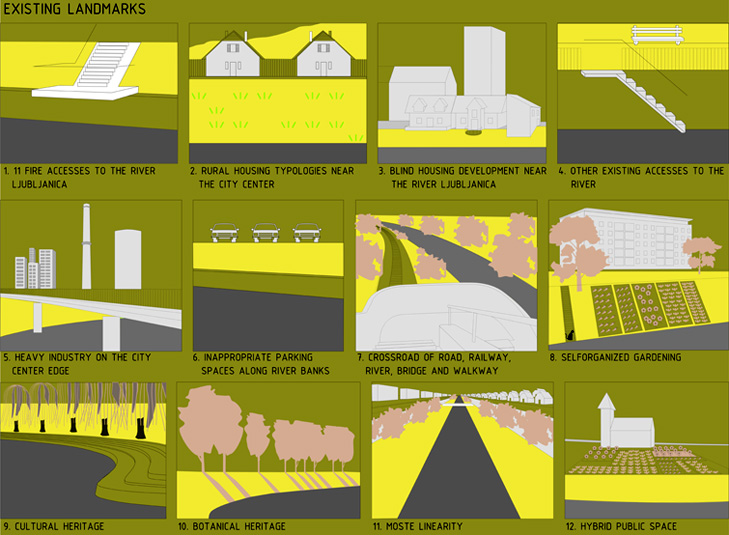
A quality architectural heritage in the historic part of the city, a collage of different typologies in the suburbs, existing tree-planted avenues on the steep grassy pedestals of the “Poljane” dykes, a linear movement, private gardens on the river quays, intimate acceses to the river, willows above the terraced meanders.
The existing environment, experienced in various spatial frequences, produces impulses that are then compressed together into a critical mass of potentials and can be used in the genesis of new spatial situations, in the same or in other locations.
Transmission of the impulses on a site means a compression of the similar spatial, structural and operational characteristics that can be found anywhere along the river, in the city or in its nearest surroundings.
What do we do? We produce new spatial situations.
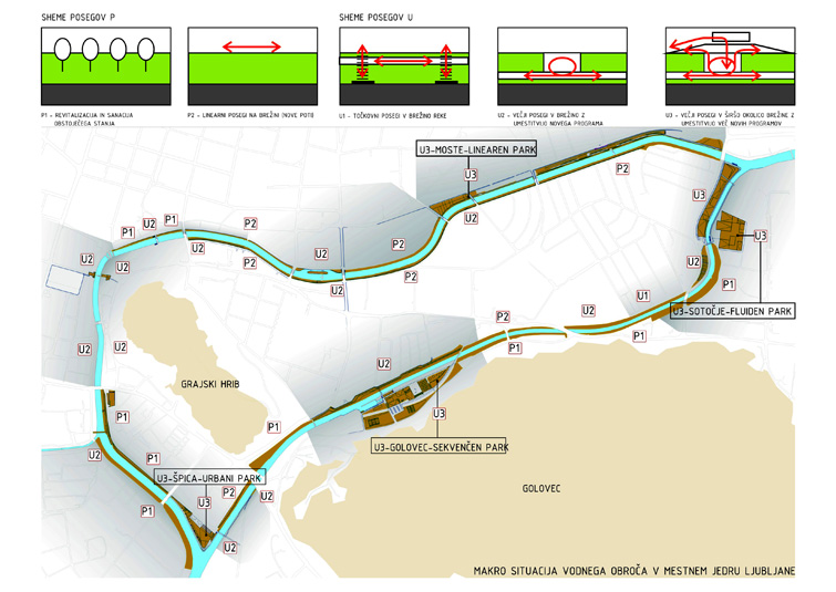
The project proposal introduces P1, P2, U1, U2 and U3 interventions that differ between themselves in the intensity of an intervention in the site.
P1 interventions present revitalization and sanation of existing environments, it means a renewal and a completion of existing tree-planted avenues or river banks. Exceptional ambiences ought to be preserved, abandoned ambiences along the water and those of specific circumstances of natural environment that do not allow developing into spatial potentials.
P2 interventions are minimal interventions in existing environments, mostly adding new infrastructures - walkways and cycle tracks on a street level. They are punctual interventions in a narrow area of the river bank where accesses to water are needed.
U1 interventions are punctual and linear additions of a new infrastructure (new paths, cycle tracks and accesses to the river) on the river bank.
U2 are middle interventions into the river bank area with additions of a new program in/on the river bank that stimulates movement and connects two different hight levels.
U3 are interventions on a wider river bank area with addition of a few different programs that are linked with the river and the city.
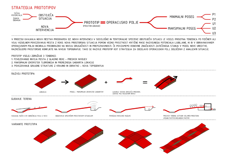
In the process of introduction of new urban programs and new interventions into sociological/social and territorial specifications of the existing environments, a tendency for a physical or visual connection of the city with the river is always present . A new spatial situation always means a presence of developmental potential of its critical mass in the city of Ljubljana. It should initiate the transformation on a level of diversity and recognition in the operational field. We resume basic characteristics of the existing environment, integrate them into the model of a new settlement and than we solve the spatial conflicts on a topographic level. Thus the prototype, as a strategy, is developed for handling all operational fields defined by the analysis of the situations.
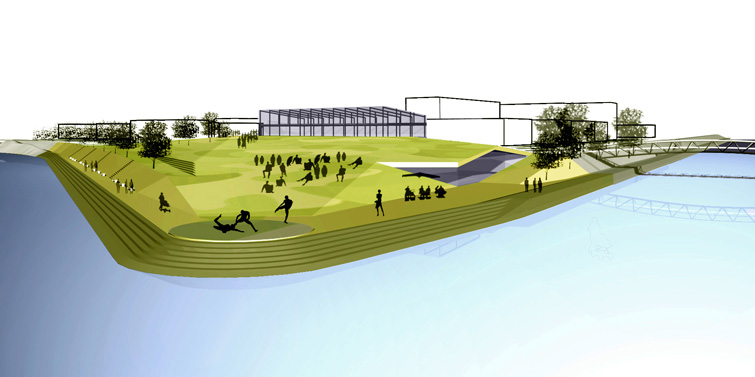
U3-ŠPICA- URBANI PARK
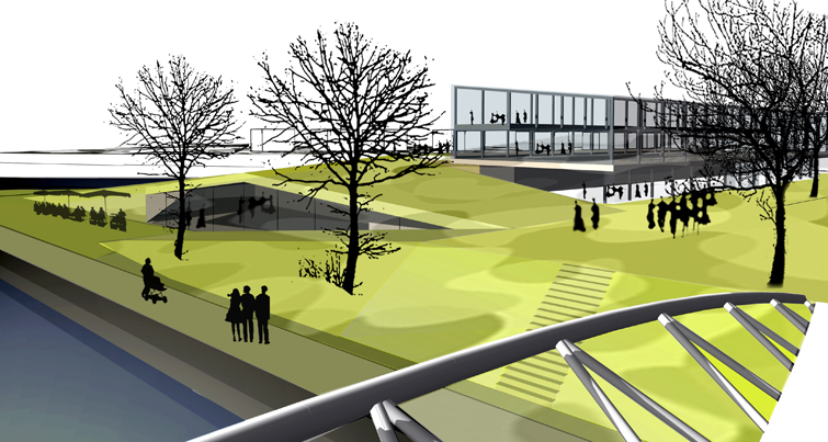
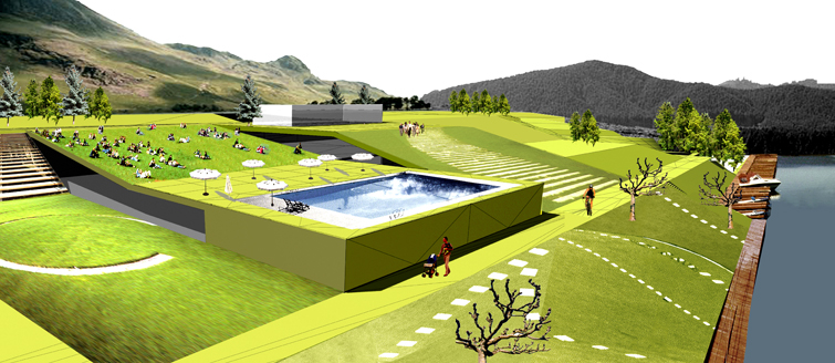
A park is an ambience prepeared for various events. It is an attractive environment that offers and enables complete experience of the ambience. The “Špica” is, above all, a water ambience. So, we suggest that a spatial concept of the park enables the closest contact with water along the whole range of the site.
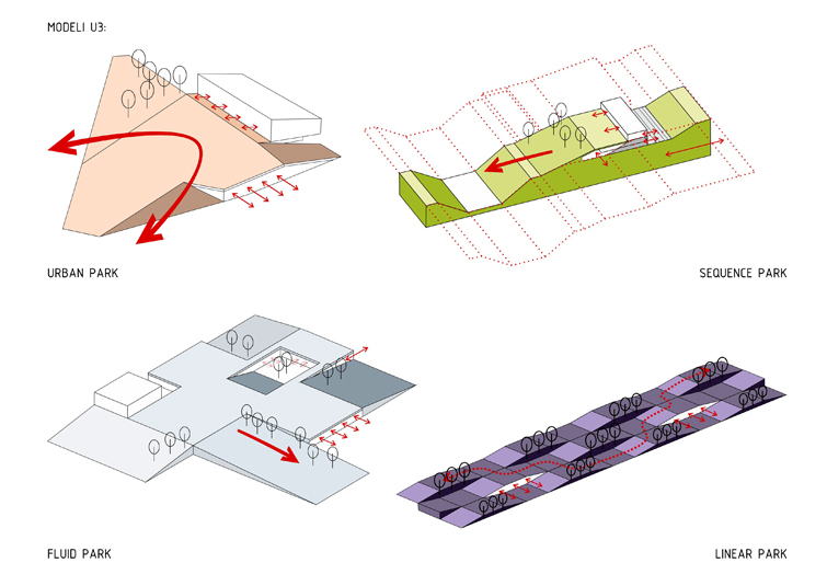
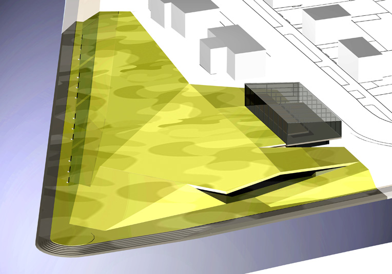
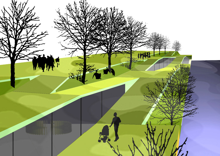
An urban park adjusts its conception to a river. It combines a compactness of an urban structure and its fluid traversing with a changeability of the landscape. Our movement and perception are gently guided; a fluid ascending and descending of the space are percepted and discovered gradually. The structured topography enables greater interaction to the landscape and its built structure.
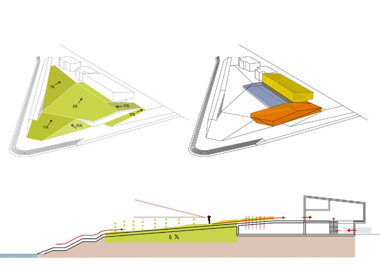
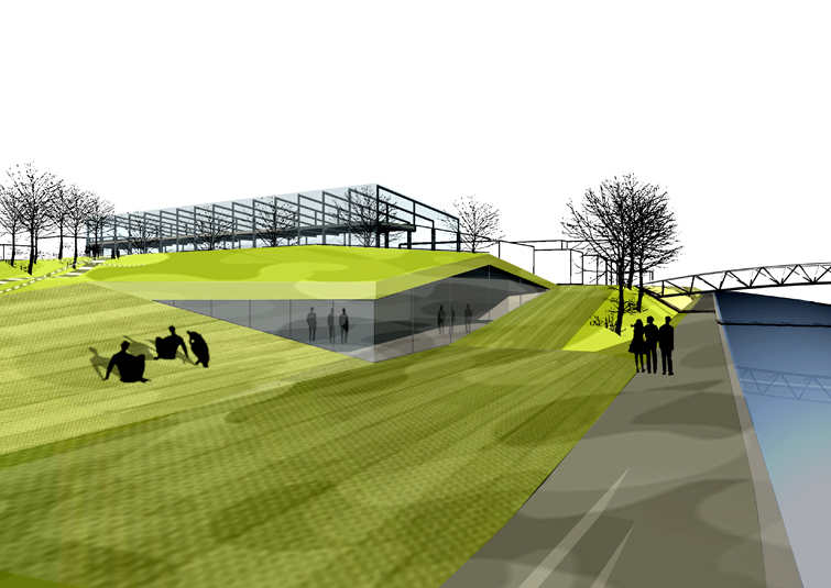
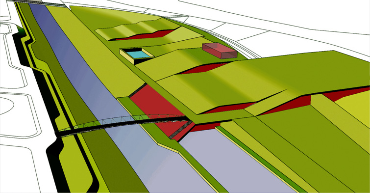
The urban park dimension/proportion is defined by a maximum site limits. The entire park becomes a gentle slope along the river. Park is combined of a parterre, a podium and a building-pavilion. The podium is composed of gentle slopes which enable fluid traversing between the ambiences, quality sights on the river, better physical connection of the park with the river and better difference in height from the street.
A rise of the slope enables a multi-layered functioning of the park ground floor.
An amphitheatrical concept of the podium situated on the gentle slope enables uttermost river sights, new possibilities and further ambient utilities.
New experiences of the urban topography generate a wider gravitational field of the park that becomes recognizable in the urban structure.
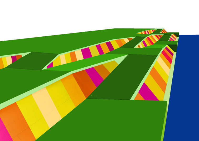
THE U3 - LINEAR PARK
It presents a tendency to gradually connect the upper street level with the river bank. A formation of linear stripes, fluidly traversing one into another via the slopes, generate folded p
